

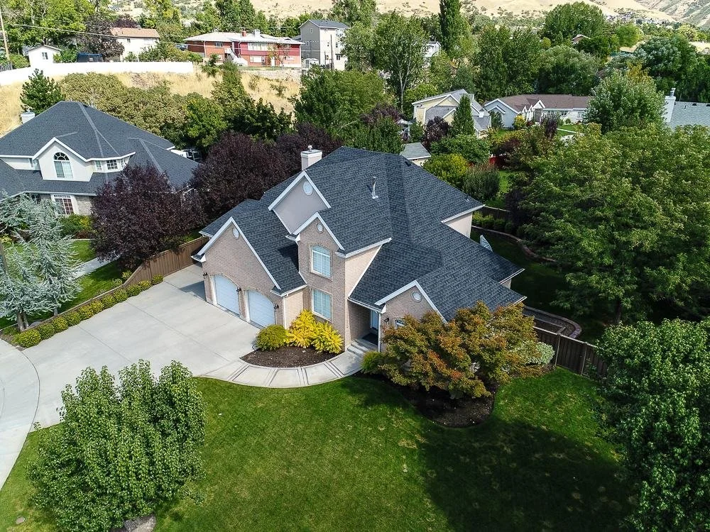
Buyers today form an opinion about a property within seconds of seeing the first photo online. That first impression often decides whether they click through to view more images or scroll past the listing entirely. This is where drone real estate photography has changed the way homes are marketed. Aerial images give buyers a broader, more accurate view of a property, its layout, and its surroundings, something ground level photography alone cannot always achieve.
At Sierra Connect Media, we work with agents, brokers, and homeowners who want their listings to stand out with clear, well composed visuals. This article explains what drone real estate photography is, when it makes the most sense to use it, and how it fits alongside traditional real estate photography to help a property sell faster.
What Is Drone Real Estate Photography?
Drone real estate photography uses a remote controlled aerial camera to capture images and video of a property from above. Instead of relying only on interior shots or a few exterior angles taken from the ground, a drone can show the full footprint of a home, its roofline, the layout of the yard, nearby amenities, and how the property sits in relation to its neighborhood.
This method has become a standard part of many real estate photography services, particularly for listings where the size of the lot, the view, or the surrounding area adds real value to the sale. It is not meant to replace interior and exterior ground photography but to add context that helps buyers understand the complete picture of what they are considering.
Why Aerial Images Matter in Today's Property Market?
Online listing platforms are the first stop for most home buyers. A listing with a strong mix of photo types tends to hold attention longer and generate more inquiries than one with limited or repetitive images.
Faster Buyer Engagement
Aerial shots break up a photo gallery and give viewers a reason to keep scrolling. A wide establishing shot from above often works well as one of the first images in a listing because it sets the scene before buyers move into interior details.
Better Representation of Large Properties
For homes with acreage, multiple structures, or extensive landscaping, ground level photography cannot always communicate scale. An aerial image shows the full extent of the land, which is particularly useful for rural properties, farms, and estates where the size of the lot is a selling point.
Clearer Understanding of Location
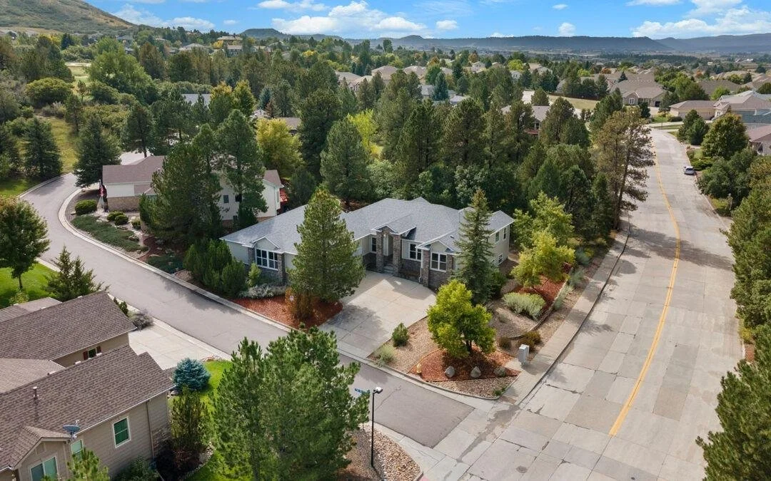
Buyers often care as much about the surrounding area as they do about the home itself. Drone shots can show proximity to parks, water, main roads, or other landmarks, giving buyers a sense of the neighborhood without needing to visit in person first.
Drone Photography vs Traditional Real Estate Photography
Both methods serve different purposes, and most successful listings use a combination of the two rather than relying on just one.
| Feature | Drone Photography | Traditional Ground Photography |
|---|---|---|
| Best for | Large lots, acreage, waterfront, neighborhood context | Interior rooms, room details, staging |
| Perspective | Aerial, wide area view | Eye level, close range |
| Shows scale of land | Yes | Limited |
| Shows interior finishes | No | Yes |
| Weather dependent | Yes, requires clear conditions | Less affected |
| Regulatory considerations | Airspace and local drone regulations apply | None |
| Typical use in listing | Opening or closing images, exterior context | Majority of gallery images |
As the table shows, aerial and ground based images are not interchangeable. A well rounded listing typically opens with an aerial shot to establish context, follows with exterior ground shots of the entrance and landscaping, then moves into interior rooms photographed at eye level.
When Should You Use Drone Photography for Your Listing?
Not every property benefits equally from drone photography. Knowing when aerial images add real value helps avoid unnecessary costs and keeps the photo gallery focused on the property's strongest selling points. Drone photography is particularly useful for homes with large lots, expansive outdoor spaces, pools, waterfront views, unique architecture, or desirable surrounding areas. In these cases, aerial images can give potential buyers a better understanding of the property's size, layout, location, and surroundings than traditional ground-level photos alone.
Large Estates and Acreage
Properties with several acres, outbuildings, or extensive gardens benefit from an aerial view that shows how the land is arranged. This is one of the most common reasons agents request drone coverage as part of their real estate photography services.
Waterfront and Scenic Properties
Homes near lakes, coastlines, or mountains often have views that are difficult to convey from ground level. A drone shot can capture the relationship between the home and its natural surroundings in a way that supports the asking price.
Neighborhood and Community Context
For buyers relocating from another city or state, seeing the layout of the neighborhood, nearby schools, or community amenities from above can answer questions they would otherwise have to research separately.
Commercial and Multi Unit Properties
Aerial images are also useful for commercial listings, apartment complexes, and new developments where showing the full building footprint or site plan helps buyers and investors evaluate the property more quickly.
How Professional Property Photography Combines Ground and Aerial Shots?
The strongest listings do not rely on drone images alone. Professional property photography typically follows a structured approach that pairs aerial and ground level images to tell a complete story of the home.
A typical shoot might begin with an aerial overview to establish the property boundaries and surroundings, followed by exterior shots of the front entrance, landscaping, and any outdoor living spaces. Interior photography then covers the main living areas, kitchen, bedrooms, and bathrooms, usually shot with wide angle lenses and consistent lighting to keep the gallery visually cohesive.
This layered approach is part of why working with experienced real estate photography services tends to produce more consistent results than combining separate vendors for each type of shot. Consistency in lighting, editing style, and framing across both aerial and ground images helps a listing look polished rather than pieced together.
Choosing the Right Real Estate Photography Services
When selecting a provider for a listing, a few practical factors are worth considering beyond price.
Licensing and insurance matter for drone operation, since commercial drone flights in most regions require a certified remote pilot and adherence to local airspace rules. Turnaround time is also important, particularly in competitive markets where listings need to go live quickly. Reviewing a provider's past work, including how they balance aerial and interior shots, gives a clearer sense of what to expect.
You can view examples of how aerial and interior photography are combined across different property types in our portfolio, which includes a range of residential and commercial projects.
Tips for Getting the Best Results from Real Estate Photographers
A few preparation steps can make a noticeable difference in the final images, regardless of whether the shoot includes drone coverage.
Scheduling the shoot for a clear day with soft natural light, usually early morning or late afternoon, helps both aerial and ground shots look their best. Tidying the exterior, including moving vehicles, coiling hoses, and mowing the lawn, ensures the property photographs cleanly from above. For interiors, decluttering surfaces and opening curtains to let in natural light supports the overall consistency of the gallery.
Working with experienced real estate photographers who understand both the technical and regulatory sides of drone photography also reduces the chance of delays or rescheduling due to weather or airspace restrictions.
Final Thoughts
Drone real estate photography has become a practical tool for showcasing properties where scale, location, or surroundings play a role in the buying decision. It works best as part of a broader photography strategy that includes interior and exterior ground shots, rather than as a standalone service.
If you are preparing a listing and want to determine whether aerial imagery would benefit your property, our team can walk you through the options based on the size, location, and features of your home. Contact us to discuss your property and find the right combination of photography services for your listing.
Frequently Asked Questions
-
No. It adds the most value for properties with significant land, scenic views, or a location where the surrounding area is part of the appeal. Smaller homes on standard lots often do not need aerial coverage.
-
In most regions, yes. Commercial drone photography typically requires the operator to hold a valid remote pilot certification and follow local airspace regulations, particularly near airports or restricted zones.
-
A typical session for a residential property takes between thirty minutes and an hour, depending on weather conditions and the number of angles required.
-
Yes. Aerial footage is often paired with walkthrough video or 3D virtual tours to give buyers a more complete view of the property before scheduling an in person visit.